Data Automation & Pipelines
At Spatialty, we specialize in making data work smarter—not harder. With deep expertise in Safe Software’s FME Platform and powerful, flexible Python scripting, we build automated workflows that move, transform, validate, and integrate geospatial and non-spatial data across your organization.
Whether you’re syncing systems, cleaning datasets, or publishing dynamic web layers, we help you cut manual steps, reduce errors, and ensure your data is always current and ready to support decision-making.
Our Automation Philosophy
Data doesn’t live in one place, and it doesn’t sit still. That’s why we focus on repeatable, scalable, and resilient automation solutions that fit seamlessly into your existing workflows and systems.
From ETL pipelines that clean and load data into ArcGIS Enterprise, to scripts that keep dashboards and web maps fresh and reliable, our solutions are designed to reduce overhead and unlock insight faster.
What We’ve Built
- FME Workbenches that automate:
- Nightly extracts from asset management systems (e.g., Cityworks, Maximo).
- Integrations with ServiceNow, Jira, and custom REST APIs.
- Conversion of CAD files into clean GIS features with QA checks.
- Real-time feeds into ArcGIS Feature Services using FME Server (Flow).
- Validation routines for schema compliance, geometry integrity, and metadata completeness.
- Python Scripts for:
- Admin automation in ArcGIS Enterprise (e.g., user provisioning, WebGISDR backups).
- Content migration between Enterprise environments or from AGOL to Enterprise.
- Custom geoprocessing tools and batch publishing routines.
- Custom tools and scripts for Public Transit (ADA Generator, Stop Management & Reviews, Origin-Destination.
Why Our Clients Choose Us
- Certified Expertise: FME Certified Professional, 40+ years of combined FME and Python scripting experience.
- Cross-System Integration: We connect GIS with permitting systems, IoT platforms, databases, and more.
- Operational Insight: Dashboards, logs, and alerts to keep automations visible and trustworthy.
- Human-Centered Design: Our tools are built for real users, not just developers.
Automation in Action
We’ve helped organizations:
- Reduce hours of manual work to minutes with scheduled FME jobs.
- Move entire datasets between systems with confidence and auditability.
- Set up automated QAQC that prevents bad data from entering the system.
- Ensure field data updates are reflected in web maps in near real-time.
Let Us Automate the Hard Stuff
Whether you’re just getting started with automation or ready to scale what you already have, Spatialty can help. We can assess your current workflows, identify automation opportunities, and deliver clean, maintainable solutions built in FME, Python, or both.
Let’s build something that works while you sleep.

Spatialty’s Geospatial Philosophy
Spatialty emphasizes a modern GIS approach centered on automation, accessibility, and education, transforming challenges into opportunities and enhancing organizational decision-making through geospatial intelligence.
Keep reading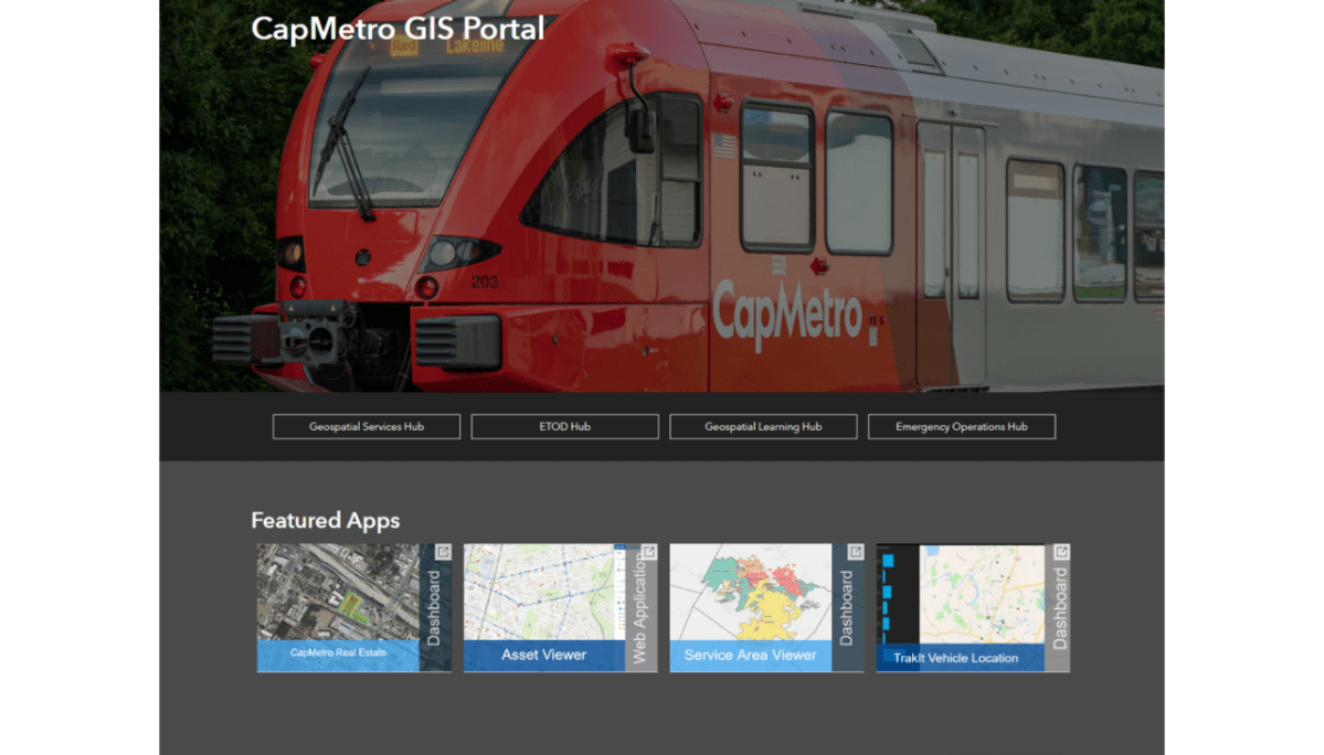
Esri Case Study: From Data Chaos to Clarity: How CapMetro Built an Enterprise GIS for Transit
CapMetro’s recent feature in an Esri case study highlights their development of a cloud-based geospatial infrastructure. Key efforts include automating data pipelines and migrating to…
Keep reading
CapMetro’s Success: Automating Transit with FME and ArcGIS
Safe Software highlighted CapMetro’s Geospatial Program in a success story, showcasing the integration of FME and ArcGIS to enhance transit operations, planning, and performance management.…
Keep reading
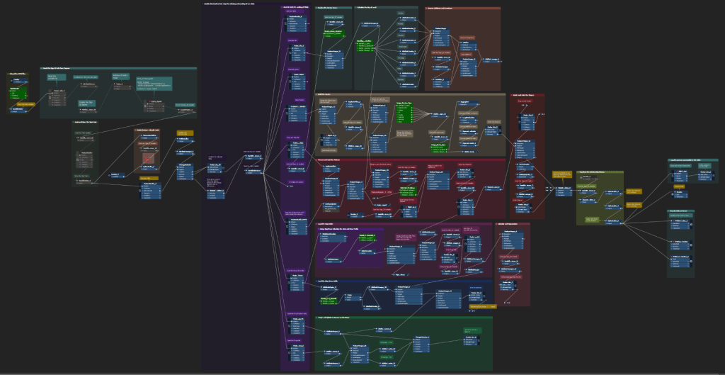
Example: Using FeatureHolder in FME Workflows
Why and when to use the FeatureHolder transformer in FME workflows.
Keep readingSomething went wrong. Please refresh the page and/or try again.

